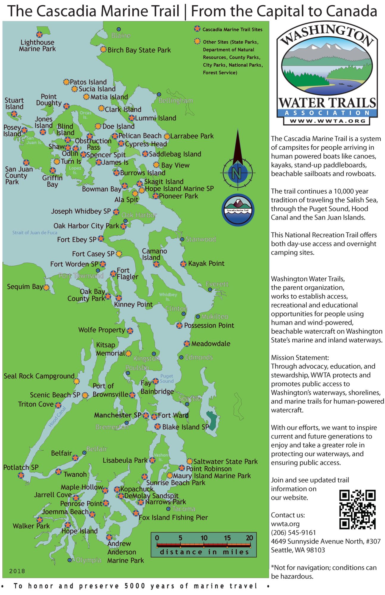
We have been working on a new poster-sized map of the Cascadia Marine Trail! We are hoping to mount this at some of our trail sites, along with a container for brochures. Please let us know if you have any feedback. We don’t have room for every put-in and take-out, but most of our sites are represented.
See our new poster – here is a JPEG and PDF version.
PFD – 2018 Cascadia Marine Trail Map

6 thoughts on “Our New Cascadia Marine Trail Map!”
Is the Wingehaven campsite on the NE side of Vashon still good? One of your maps lists it as a campsite while your other map does not. I got to both maps from this site. Thanks
Hi Kerry,
Thank you for asking. The road into Wingehaven needs work so the site can be maintained, so it is “off the chart” for now. We are trying to work with the Vashon Parks department to get it fixed.
Andree
Thank you for your quick response.
Great map! Though your marker for Larrabee State Park should be about 4-5 miles north of where it shows on the map.
I’ve recently noticed the three campsites on Vashon Island are now managed by Vashon Adventures and their websites say they are closed October-May. So camping is not allowed there in winter? Winter is my favorite time to kayak camp!
Hi Mario, Thank you for the inquiry. Vashon Island Parks replied: Yes, camping is fine there in the off season without reservation. During the spring and summer, we institute the reservation system through Vashon Adventures to keep some eyes and ears on the properties when the parks are so busy. If possible, we do like to be notified of use in the off season, so we can inform the gate attendants to expect somebody there.