The name Kopachuck originates from the Chinook language. “Kopa” means “at” and “chuck” means “water.” The park has an underwater park and a wooded forest that includes a lush mix of fir, ferns, and salal.
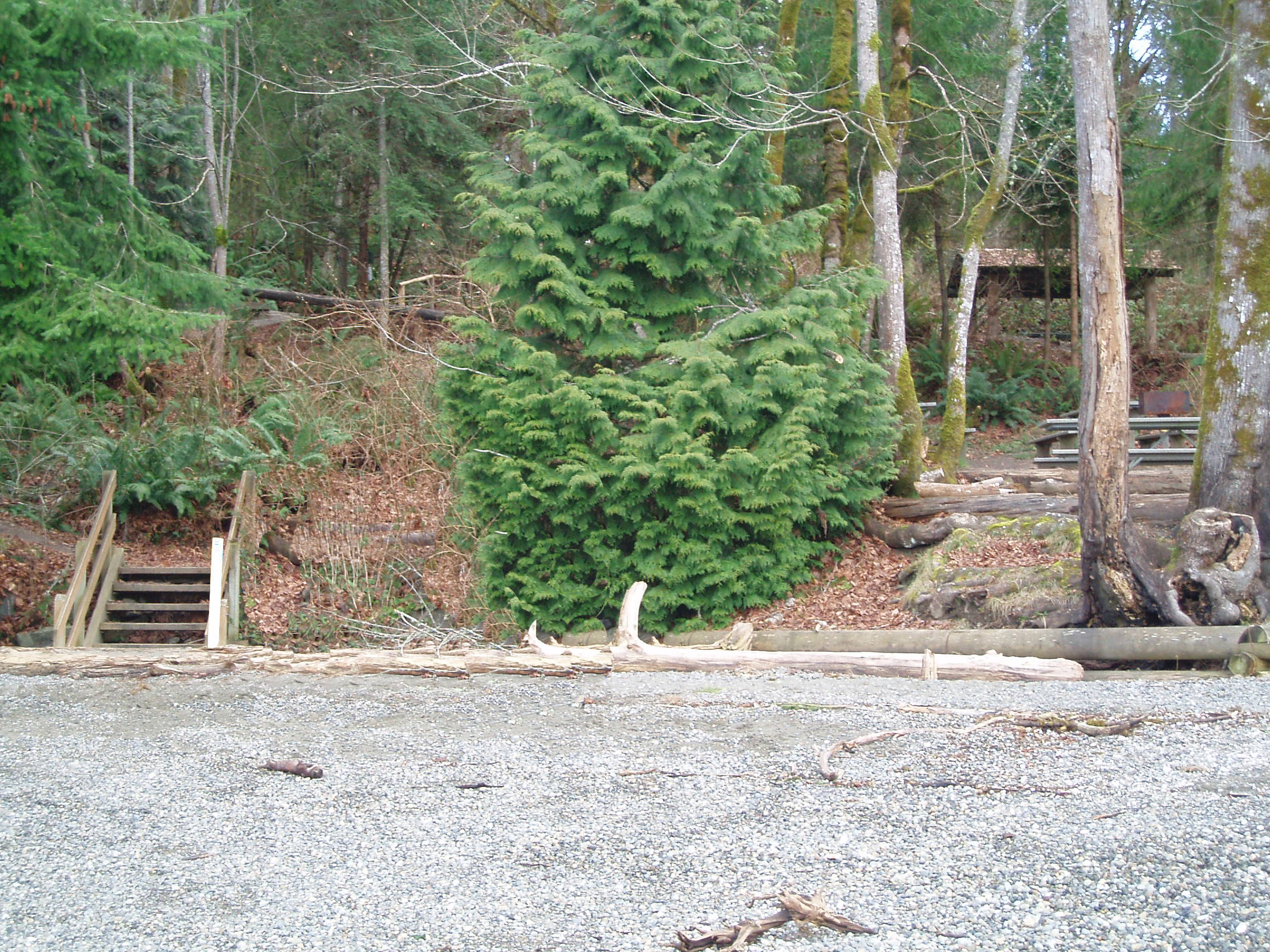
Approach: Gravel and sand beach at north end of park. Use caution when walking up stairs and carrying boats from the beach to the campsite.
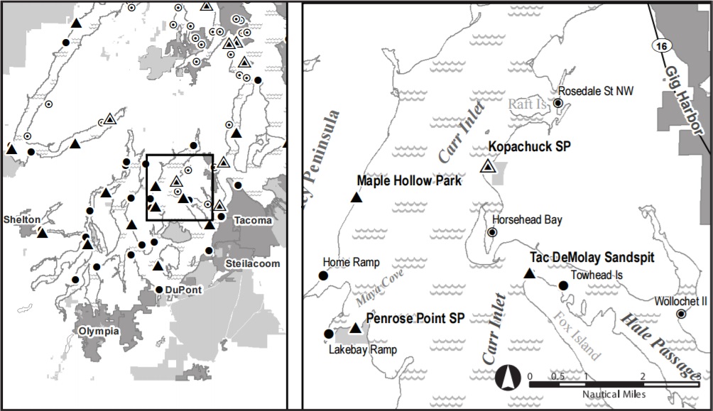
Location: Kopachuck State Park is located on the E shore of Carr Inlet just north of Horsehead Bay. The site is a short hike uphill from the main day-use beach near the north boundary of the park.
Hazards: Winds tend to pick up in the afternoon.
Sites: 1
Water: Water is available March-November along the waterfront trail and at restroom 500 feet south of campsite. Winter water supply at restroom adjacent to the day use parking lot.
Sanitation: Restrooms are available April-November at the restroom 500 feet south of site. Winter restroom available in day-use parking lot.
Overflow: In the rest of campground
Fires: Only in established fire rings
Extras: Picnic shelter and kayak rack at site
Fees: $12/night for up to 8 in site
Special Considerations: Campers are advised to store boats on kayak rack at campsite, uphill from the beach. Boats left at the beach may be vulnerable to vandalism.
Natural History: Take the time to visit Cutts Island, a Marine State Park that is approximately a 20-minute paddle from Kopachuck. Also known as Deadman’s Island, local lore paints the island as an Indian burial ground. It is said that the dead were put in hollowed-out log canoes, which were then placed in the forks of trees so they would be closer to heaven.
Reservations: No
Latitude: 47.3107
Longitude: -122.6869
Additional Resources: Google Maps Page, Guide Book PDF